







Where Did the Hurricanes Go This Year? What the Super El Niño Means for Southwest Florida
by Eduardo Roman on Oct 06, 2026Southwest Florida has reached October without a single Atlantic hurricane in 2026. Eight named storms formed, none reached hurricane strength, and September passed without a hurricane for the first time since 1994. The reason isn't luck. A super El Niño, the strongest ever measured by the daily Niño 3.4 index, has been sitting over the Pacific all summer, and El Niño is the climate pattern most reliably tied to a quiet Atlantic. The hurricanes didn't disappear. They went to the Pacific. Here's why, what this super El Niño means for Southwest Florida over the next year, from Lee and Charlotte down to Collier, and why a quiet season is the time to get hurricane protection on the house rather than a reason to put it off.
As of October 5, 2026: eight named storms, no hurricane. In its 2 pm outlook the National Hurricane Center gave a trough of low pressure over the southwestern Gulf a 60 percent chance of forming in the next two days and an 80 percent chance within seven, and said a tropical depression is expected to form during the middle portion of the week. It expects the system to drift east for a couple of days, then turn north. The season runs through November 30.
Key takeaways
- Through early October the Atlantic has produced eight tropical storms and no hurricane. On September 21 this became the first season since 1914 to go that late without one. Only 1907 and 1914, both before satellites, ended hurricane-free.
- A record super El Niño is the cause. It adds wind shear and dry, sinking air over the Atlantic, and it moved the storm engine to the eastern Pacific, which has had 20 named storms, 10 hurricanes and three Category 5s through early October.
- October is the second-busiest month of the season after September, and no state has taken more October hurricanes than Florida: 32 from 1851 to 2016. The season runs to November 30. In super El Niño years the late season is usually quiet, but not always.
- The same El Niño points to a wet, stormy winter, with nearly twice the tornadoes of a neutral or La Niña year in Central and South Florida, by National Weather Service figures. And by FOX Weather's count, four of the five super El Niños since 1970 were followed by La Niña the next year, which would favor a busier Atlantic.
- Hurricane screens typically take 40 to 60 days from the measure to the install, a typical range rather than a guarantee. An order placed this fall is normally finished well before June 1, 2027, ahead of the spring months when Florida's searches for hurricane shutters run about twice as high as in winter.

The longest wait for a first hurricane in more than a century
Through October 5 the 2026 Atlantic season has produced eight named storms and zero hurricanes: Arthur (June 17 to 18), Bertha (July 19 to 24), Cristobal (August 12 to 13), Dolly (August 27 to 28), Edouard (August 31 to September 3), Fay (September 19 to 29), Gonzalo (September 25 to 26) and Hanna (September 28 to 30). The strongest, Tropical Storm Fay, peaked at 70 mph with a pressure of 995 millibars, just under hurricane strength. Three made landfall in the United States, all in Texas and Louisiana, and Gonzalo crossed the Cabo Verde Islands. None touched Florida.
The records fell one after another. The previous latest first hurricane was September 11, a mark shared by Gustav in 2002 and Humberto in 2013; 2026 tied it on September 11 and passed it on September 12. On September 21 it became the first season since 1914 to go that deep into the year without a hurricane, and only the third since records began in 1851. September ended without a hurricane for the first time since 1994, and only the third time since World War II (1962, 1994 and now 2026). Accumulated cyclone energy, the index forecasters use to add up how much storm activity a season produced, stands at 10.8 units.
Only two seasons in the hurricane database, 1907 and 1914, ended with no Atlantic hurricane at all, and those records come from before satellites and hurricane hunter aircraft, so a storm or two out at sea may have been missed. By named storms, 2026 isn't the fewest on record: 1983 had four and 1992 had seven. By the wait for a first hurricane, nothing in the modern record compares.
Forecasters saw a slow year coming. NOAA's May 21 outlook called for 8 to 14 named storms, 3 to 6 hurricanes and 1 to 3 major hurricanes (the 30-year averages are 14, 7 and 3), with a 55 percent chance of a below-normal season. Its August 6 update went lower, 7 to 13 named storms, 2 to 6 hurricanes and 0 to 2 major hurricanes, with a 75 percent chance of a below-normal season, and noted that El Niño conditions had emerged in June. Colorado State University called for 9 named storms, 4 hurricanes and 1 major hurricane on July 8 and held that forecast in its final update on August 5. Both pointed at the same cause. Neither expected zero.
Why a record El Niño means fewer Atlantic hurricanes, not more
It's easy to assume a record-breaking climate event should mean a record-breaking storm season. For the Atlantic, El Niño works the other way.
El Niño is a warming of the ocean surface along the equator in the central and eastern Pacific. Forecasters track it in a patch of that ocean called the Niño 3.4 region, and by the daily reading there the 2026 event is the strongest on record: on September 21 the sea surface temperature anomaly, the amount above normal, reached 3.11°C, above the 3.08°C daily peak of November 18, 2015, according to Carbon Brief. Fourteen seasonal models put the monthly peak near 4.1°C between November and January. In its September 10 discussion, NOAA's Climate Prediction Center gave it more than a 90 percent chance of staying very strong through the winter and a 75 percent chance that October through December would exceed every El Niño since records began in 1950. The center's official three-month ranking isn't final; its next discussion comes on October 8.
That warm water pulls thunderstorm activity east across the Pacific, and the ripple effect reaches the Atlantic in three ways, as NOAA's researchers describe it:
- Wind shear. Wind shear is the change in wind speed or direction with height. El Niño strengthens the upper-level westerly winds and the low-level trade winds over the Caribbean and tropical Atlantic, which raises the shear. A developing storm needs its thunderstorms stacked vertically; shear tilts and tears the stack apart before it can organize.
- Sinking air. El Niño increases sinking motion over the Atlantic, which makes the atmosphere more stable and harder for thunderstorms to build in.
- Dry air. That sinking motion also dries the middle of the atmosphere. Hurricanes need deep moisture. This summer they didn't get it.
Warm water alone doesn't make a hurricane. A storm also needs light shear, moist air and an unstable atmosphere at the same time, and in 2026 those didn't line up. Colorado State's Phil Klotzbach summed the season up in August as "higher wind shear and sinking, dry air."

So where did the hurricanes go? West
The energy didn't vanish. It moved to the other side of Mexico. Through early October the eastern Pacific has had 20 named storms, 10 hurricanes, 8 major hurricanes and three Category 5s (Genevieve, Lowell and Polo), tying 1994, 2002 and 2018 for the most Category 5 hurricanes in a Pacific season. Hawaii, where a direct hurricane hit is rare, took two: Hurricane Lala was the first hurricane to directly hit the Big Island since 1871, and Hurricane Lowell was the first to directly affect Kauai County since Iniki in 1992. Hurricane Nolo followed in late September, bringing flooding and landslides to the Big Island. Polo peaked at 180 mph with a pressure of 892 millibars, the second most intense Pacific hurricane on record by pressure.
That's the El Niño signature. NOAA's climate blog puts it in one sentence: El Niño favors stronger hurricane activity in the central and eastern Pacific and suppresses it in the Atlantic. The storm engine ran all summer. It just ran on the other ocean, and that's the best weather news Southwest Florida has had all year.
October and November are still hurricane season
The season doesn't end on September 10, the statistical peak. It ends on November 30, and for the Gulf coast of Florida the back half matters. In October the favored development zone shifts west, out of the open Atlantic and into the western Caribbean, the eastern Gulf and the far western Atlantic, which puts it closer to our coast and on tracks that cross the peninsula. In a typical season September is the most active month and October the second, FSU climatologist Emily Powell told the Palm Beach Post at the end of September, and no state has taken more October hurricanes than Florida: from 1851 to 2016, 32 made a Florida landfall in October. One more caveat this year, from the same interview: Gulf sea surface temperatures are record warm for this time of year.
Some reminders from recent years:
- Hurricane Wilma was named on October 17, 2005, became a hurricane on the 18th and a Category 5 before dawn on the 19th. The National Hurricane Center called its 24-hour jump from a 70 mph tropical storm to a 175 mph Category 5 unprecedented. It peaked at 185 mph with a pressure of 882 millibars, then came ashore near Cape Romano in Collier County around 6:30 am on October 24 as a Category 3 with 120 mph winds.
- Hurricane Milton was a tropical storm on October 5, 2024, and a Category 5 with 180 mph winds on October 7. It made landfall near Siesta Key on October 9 as a Category 3.
- Hurricane Nicole made landfall just south of Vero Beach at about 3 am on November 10, 2022, as a Category 1 with 75 mph winds: the first November hurricane to hit the Florida peninsula in 87 years, and only the fourth November hurricane landfall on the U.S. mainland on record.

Now the other side of it, because both are true. In the super El Niño years since 1950, the Atlantic produced nine October and November storms, and only three became hurricanes: Elena in 1965, and Joaquin and Kate in 2015. Three of those five seasons had no hurricane at all after September 30. A record El Niño does lower the odds for the rest of this season. Lower odds are not zero odds. Late October 2025 produced a Category 5, Melissa, and as hurricane specialist Michael Lowry puts it, the season is quiet until it isn't.
Quiet seasons have hit Florida before
A slow season and a bad year for Florida are not the same thing. The record is full of years where the basin was quiet and one storm did the damage, and one year where El Niño didn't quiet the basin at all:
| Year | What the season looked like | What Florida got |
|---|---|---|
| 1965 | Strong El Niño | Hurricane Betsy, the first hurricane to exceed a billion dollars in damage |
| 1992 | Seven named storms, the summer after a waning winter El Niño | Hurricane Andrew, a Category 5 with 165 mph winds in South Florida |
| 2004 | The Pacific was transitioning into a weak El Niño | Four hurricanes, including Charley's Category 4 landfall at Cayo Costa in Lee County on August 13, with 150 mph winds |
| 2015 | One of the strongest El Niños on record, 11 named storms and 4 hurricanes | No U.S. hurricane landfall, the last season that could say so |
| 2023 | Strong El Niño, but record-warm Atlantic water won: 20 named storms and 7 hurricanes, the fourth-most named storms since 1950 | Hurricane Idalia, a Category 3 with 115 mph winds near Keaton Beach in the Big Bend on August 30 |
Andrew is the one Southwest Florida should remember. 1992 produced seven named storms, and one of them is still the benchmark for what a Category 5 does to a neighborhood. The number of storms in a season tells you very little about the one that reaches your street.
It also helps to remember that hurricane-free years are normal for Florida even when the Atlantic is busy. Between Wilma on October 24, 2005, and Hermine on September 2, 2016, Florida went 3,966 days without a hurricane landfall while 68 straight Atlantic hurricanes, Beta in 2005 through Gaston in 2016, came ashore somewhere else or stayed at sea. What's unusual about 2026 is the basin, not the state.
What this super El Niño means for Southwest Florida beyond hurricanes
The hurricane lull is one effect of this El Niño. There are two more that matter here.
A wet, stormy winter. El Niño winters in Florida bring above-average rain from fall through spring, storm tracks that run farther south than usual, more clouds and more severe weather, according to the National Weather Service office in Tallahassee. The office's figures: Central and South Florida average about 15 tornadoes a year under El Niño, nearly twice the count of neutral and La Niña years, and about 20 in strong El Niño years, with the severe season running from around Christmas to late spring. The 1997-98 super El Niño brought the Central Florida outbreak of February 22, 1998, at least a dozen tornadoes overnight that killed 42 people and injured more than 260, and that winter Fort Myers got roughly 24 inches of rain from November to March. The 2015-16 event made January 2016 the wettest January on record in Lee (9.54 inches), Collier (8.77 inches) and Charlotte (9.17 inches) counties, five to more than six times the monthly average, and gave Miami its wettest winter on record at 20.24 inches.
Hurricane screens and roll-down shutters are tested and approved as impact protection under the Florida Building Code's product approval system: our screens under Florida Product Approval FL16343, and our CHD-6 roll-down shutter under FL42139-R1 and FL42140-R1 with large-missile impact testing, the test that fires a 9-pound projectile at the product, to the TAS 201 standard. That approval doesn't care what month it is. A closed shutter or lowered screen is just as useful in a February squall line as in a September hurricane, and winter is when homeowners rarely think to close them. More on that in why hurricane protection matters year-round.

A busier 2027, if the pattern flips. Super El Niños don't linger. FOX Weather counted five super El Niños since 1970 and found that four of the five were followed immediately by La Niña the next year, and NOAA's Oceanic Niño Index shows La Niña within the following year after the 1972-73, 1982-83 and 1997-98 events. La Niña does the opposite of everything described above: it lowers wind shear over the Atlantic and favors a more active season. A flip would be a return rather than a novelty, since a weak La Niña formed in late 2025 and ended in early 2026, as FSU's Allison Wing noted in September. Nobody can forecast 2027 yet, and we won't pretend to. But the odds favor a swing back, and the 2027 season opens June 1, less than eight months from now.
Why a quiet season is the right time to add protection
Here is the practical part. In Southwest Florida, hurricane protection tends to get ordered in a rush when a storm is in the Gulf and installed when the calendar allows. Neither of those works in your favor.
- Lead times. Hurricane screens typically run 40 to 60 days from the measure to the installed product. That's a typical range, not a guarantee, and every system we sell is custom-measured and made to the opening, so there's no shortcut when demand spikes. Florida searches for hurricane shutters run roughly twice as high from April through July as in the winter months, by Google Trends' relative index for the past 12 months, and spring is when orders stack up. An order placed this fall is normally measured, made, permitted and installed well before next season.
- Permits. Lee County and Collier County require a building permit for shutters and storm screens, and the application lists the Florida Product Approval number of the product; the cities inside them, from Cape Coral to Naples, run their own building departments. We handle the permitting for you.
- Insurance. Opening protection is one of the features documented on Florida's Uniform Mitigation Verification Inspection Form (OIR-B1-1802), the wind mitigation form your insurer uses. The form grades opening protection by the weakest glazed opening on the house: in plain English, all or nothing. Its top level, A, means every glazed opening has verified cyclic-pressure and 9-pound large-missile protection listed in the Florida or Miami-Dade product approval system. Your carrier decides what the documented features are worth, so ask them before you order. The top grade takes rated protection on every opening, and that can't happen in the week before a storm.
- Price. Aluminum, fabric and motors cost what they cost regardless of the season. What changes is how soon a crew can get to you. Nothing about a quiet year makes protection cheaper later.
A storm doesn't shop the calendar. Wilma and Milton each went from a tropical storm to a Category 5 in two days or less. In either case, the only protection that counted was what was already on the house.

Choosing the right protection for your home
The product depends on the openings, how often you'll close it and what the HOA allows. Where we cite a Florida Product Approval below, the approval states a design pressure: the wind load, in pounds per square foot (psf), that the product is approved to resist, pushing in (plus) and pulling out (minus). The short version:
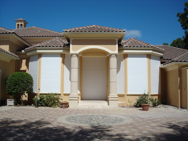
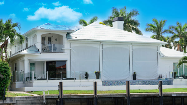
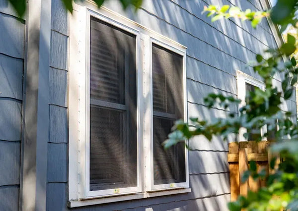
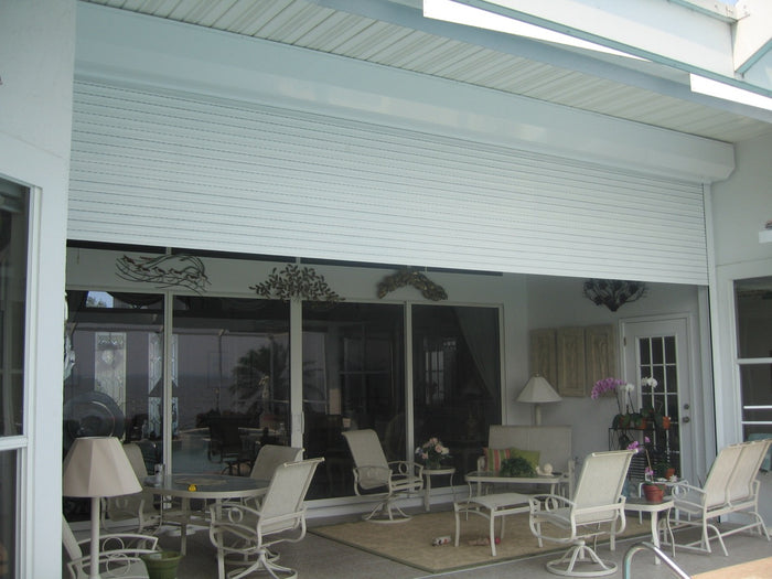
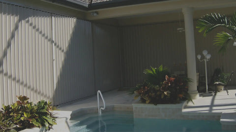
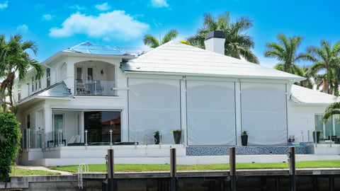
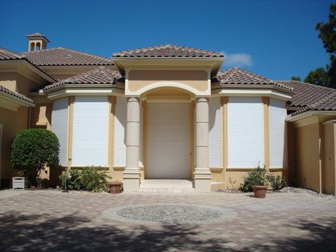
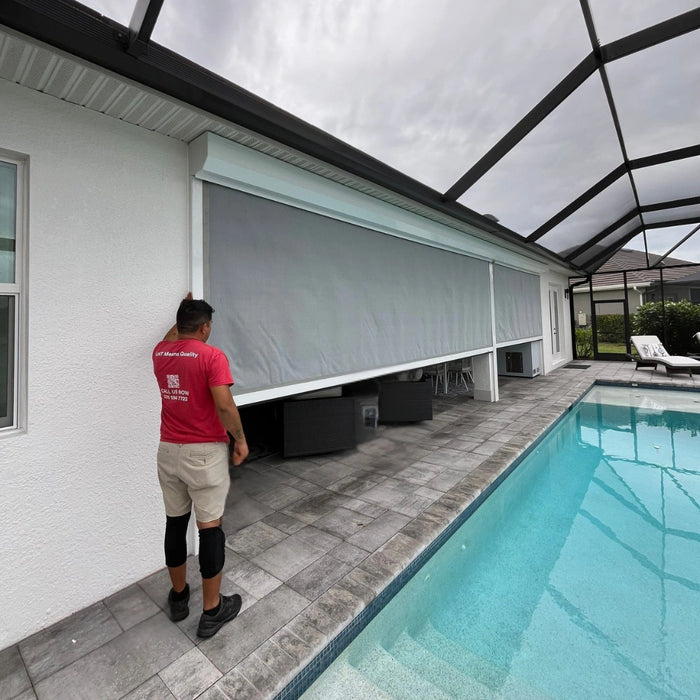
- Hurricane screens roll down over lanais, entries and wide spans, keep the view and the airflow, and are approved as impact-resistant protection under Florida Product Approval FL16343, rated to +140/-140 psf for use outside the High Velocity Hurricane Zone (HVHZ), the stricter wind zone in the Florida Building Code.
- Roll-down shutters are the highest-rated option we install for windows and sliders by approved design pressure: our roll-down approvals are rated to +200/-200 psf (FL12550) against +140/-140 psf for the screen system. They're also the most convenient, operated by switch, remote or crank.
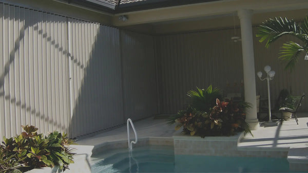
- Accordion shutters are the budget-friendly permanent option: they stack beside the opening and close by hand, with nothing to carry or store.
- Impact windows and doors protect without anything to deploy.
For a side-by-side look at the first two, read hurricane screens versus hurricane shutters, and for a checklist that covers the rest of the house, see how to prepare for hurricane season.
Products in this article

Hurricane ScreensCustom roll-down storm screens made in Fort Myers. Free in-home quote.

Roll-Down ShuttersAluminum shutters that roll up into a housing above the opening. Free in-home quote.

Accordion ShuttersPermanent shutters that stack beside the opening and close by hand. Free in-home quote.

Impact Windows and DoorsImpact windows and sliding glass doors, with nothing to close before a storm. Free in-home quote.
Questions people are asking
Will Florida get a hurricane in 2026?
Nobody can say. The season runs through November 30, October is the second-busiest month of the season after September, no state has more October hurricane landfalls than Florida, and the western Caribbean and the Gulf are where late-season storms tend to form. What the record El Niño does is lower the odds: in the super El Niño years since 1950, three of five seasons produced no hurricane after September 30.
Is hurricane season over in Florida?
No. It ends November 30. The statistical peak was September 10, but Wilma (October 24, 2005), Milton (October 9, 2024) and Nicole (November 10, 2022) all hit Florida after it.
Has Florida ever had a year without a hurricane?
Many. Florida went from Wilma in October 2005 to Hermine in September 2016 without a hurricane landfall, 3,966 days, while 68 straight Atlantic hurricanes went elsewhere. A hurricane-free year is normal for Florida. A hurricane-free Atlantic is not; the last was 1914.
Is La Niña or El Niño better for hurricanes?
For the Atlantic, El Niño means fewer hurricanes and La Niña means more. El Niño adds wind shear and dry, sinking air over the Atlantic; La Niña removes them. That's why 2026 has been so quiet, and why a flip to La Niña in 2027 would favor a busier season.
What does a super El Niño mean for Florida's winter?
Wetter, cloudier and stormier. El Niño winters bring Florida above-average rain from fall through spring and more severe weather: Central and South Florida average about 20 tornadoes a year in strong El Niño years, against about 15 under El Niño generally, with the severe season running from around Christmas to late spring.
Next step
We're Southwest Florida's largest shutter manufacturer, and we've been building hurricane protection in Fort Myers since 1994, through quiet years and through 2004, 2005 and 2024. A quiet 2026 is good news for Southwest Florida. The lesson from every quiet season before it is to use the time.
Book a free in-home visit and we'll measure every opening, walk through the options and give you a written quote. You can also get an instant estimate on that page or call (239) 251-0856. Financing for homeowners is offered through Regions Bank, Member FDIC, subject to credit approval; the current program terms are on our homeowner financing page.
Advanced Hurricane Technology · FL Lic. CBC1258522 | SCC131153977


